The Mars Orbiter Camera (MOC) used on the Mars Global Surveyor satellite orbiting Mars has generated huge quantities of new Mars pictures. In year 2000, more than 60.000 of such images have been made available to researchers. In the beginning of 2001, more than 10.000 images have already been added. I have browsed only a very small portion of these images so far.
|
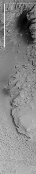
(1) a severely downsized version of the full original image. (2) the lower region shown at the bottom of 1. (1) original sized extract of the lower region shown on 2. |
(1) |
(2) 
|
(3) 
|
Liquid water on the surface of Mars? Today, Mars is a cold, arid world. The driest deserts of Earth have many factors of ten more water than the surface environment of Mars. However, Mariner 9 and Viking in the 1970s showed abundant evidence that Mars once had channels and valleys carved by liquid water. These earlier missions, however, found only equivocal evidence of places where liquid water might have ponded to form lakes, seas, or even oceans.
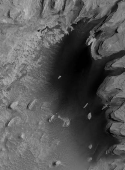
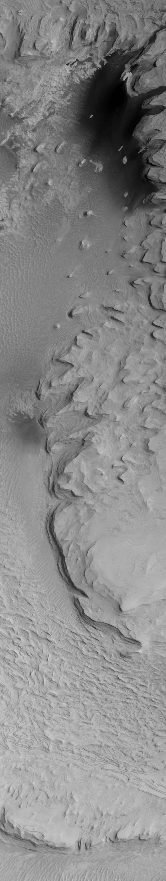
MOC image 7707 (above) shows a portion of the wall and floor of an ancient impact crater in the southern cratered terrain of Noachis Terra. The MOC image reveals v-shaped depressions on the crater wall that are characteristic of water seepage from an underground layer that is exposed in the crater walls. The image also shows a smooth, dark surface on the crater floor that might be interpreted as the remains of a pond or lake. There are two types of dark surfaces on the floor of this 50 kilometer (31 miles) diameter crater, located at 65°S, 15°W. One dark surface shows a rippled texture and is known from Viking images to be a field of windblown dunes. The other is a relatively smooth surface with "islands" of bright material within it. The boundary between the dark floor materials and the lighter materials of the crater wall suggests, by the formation of bays and peninsulas, a "ponding" relationship.
There are four general hypotheses that might explain the "pond":
As NASA says, the image shows a smooth, dark surface on the crater floor that "might be interpreted as the remains of a pond or lake". This is actually by far the simplest interpretation. When NASA says that the side near the crater wall is "a relatively smooth surface with "islands" of bright material within it", we have an understatement: it indeed absolutely smooth, it is the liquid water surface of the lake.
The reason that forces NASA to reject the idea that we see a liquid water lake is based on the notion that no liquid water can exist on Mars, due to the low temperature and low atmospheric pressure.
These reasons are not correct:
(*) The mass spectrometer supposed to have proven that there is no organic material on Mars has been tested again afterwards on Earth, and we have learned from this cross validation test that ... there is no organic material on Earth either!
NASA via JPL and MSS has already stated that liquid water has almost certainly been abundant on Mars in the past. The images released my MSSS were rightfully shown as evidence.
The MSSS statement that "the driest deserts of Earth have many factors of ten more water than the surface environment of Mars" must be revised: it depends on the location studied, it is not so in zones of water seepage and water remains. Mars might have huge desert and dried up sectors, but not the entire surface of the planet matches this description.
Whereas I agree that Mariner 9 and Viking in the 1970s did provide "only equivocal evidence" of places where liquid water might have ponded to form lakes, seas, or even oceans, the latest images from MOC in 2000 and 2001 clearly show sectors where liquid water exist, even as lakes, in a manner that is not equivocal anymore.
What we have here is one among many other such images where the only reasonable hypothesis is that they are the evidence that lakes of liquid water still exist on low altitude sectors and, or, privileged heated up sectors of the planet.
We therefore have one other piece of the growing gathering of evidence that Mars is not at all the dead planet shown to their large audience to the mass media. In addition to the evidence on this photograph we now obviously have enough cross-evidence that Mars can and does harbor life, today.
In compliance with the MSSS image use:
"All Mars Orbiter Camera images are used courtesy of Malin Space Science Systems. Pursuant to the Image Use Policy , all original imaging credit is given to NASA/JPL/Malin Space Science Systems."
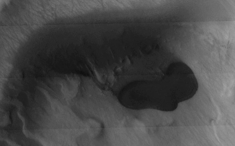
The science team of the THEMIS instrument aboard Odyssey used to detect traces of past water, is annoyed with a new image which "is causing us considerable difficulty due to the presence of a structure that resembles a lake located in the center of the crater" on one of their images, published on April 22, 2004 on their website at http://themis.la.asu.edu/zoom-20040422a.html
The image can be downloaded there or seen as extract below:
|
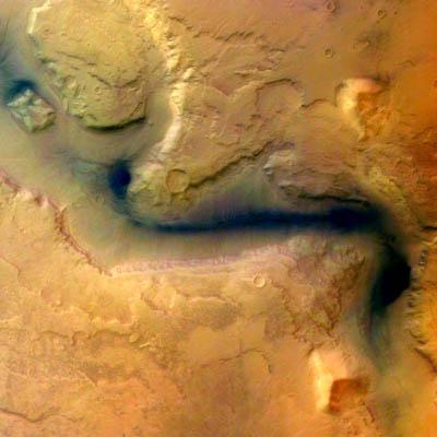
ESA comment: "The data is flooding in too fast to make sense of some mysterious features, such as a dark splotch in Mars's grand canyon and along some valleys, he said. They may be sediments that OMEGA will be able to identify."
Image number: SEMBY9474OD
Caption: Reull Vallis - HRSC image 15 January 2004
Credits: ESA/DLR/FU Berlin (G. Neukum)
|